
Contents
Fse-fire-station-location-v3.svg (SVG file, nominally 930 × 580 pixels, file size: 38 KB)
Summary
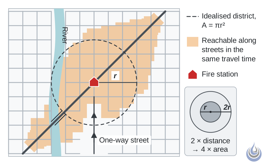
Idealised circular district (dashed) and the irregular area reachable along streets in the same travel time (shaded), as produced by a GIS network analysis.
Original illustration for Fire station location.
- Alt text: Station with a dashed circle of radius r and an irregular street-network polygon reachable in the same travel time
Licensing
New drawing by Fire Safety Academy. © Fire Safety Academy.
File history
Click on a date/time to view the file as it appeared at that time.
| Date/Time | Thumbnail | Dimensions | User | Comment | |
|---|---|---|---|---|---|
| current | 18:17, 14 November 2026 | | 930 × 580 (38 KB) | Linda (talk | contribs) | Watermark: Fire Safety Academy logo icon, 70 px, 45 % opacity |
You cannot overwrite this file.
File usage
The following page uses this file:
