
Contents
Fse-wildland-urban-interface-v1.svg (SVG file, nominally 900 × 600 pixels, file size: 7 KB)
Summary
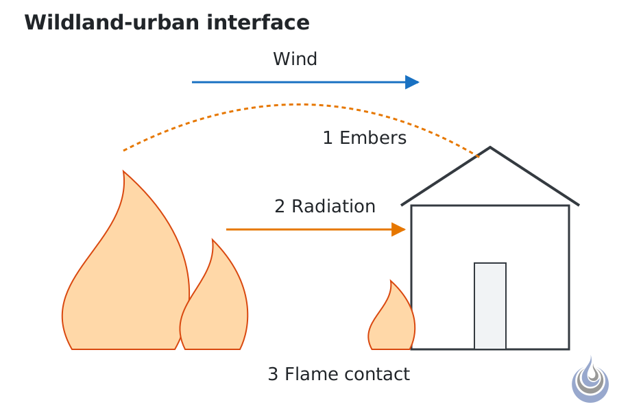
The three routes by which fire spreads from burning vegetation to a building: embers, radiation and direct flame contact. Based on National Research Council of Canada et al. (2005), p. 1.6-7, and Quintiere (2002b), p. 2-255.
Original vector illustration for Wildland-urban interface, level 2 Intermediate.
- Source basis: National Research Council of Canada et al. (2005), p. 1.6-7 (three routes) and p. 2.6-12 (brands carried by the wind); Quintiere (2002b), p. 2-255 (wind-borne embers start spot fires; crown and surface fires); Hamins, Maranghides, McGrattan, Ohlemiller, and Anleitner (2005), p. 30 (lofted brands falling onto combustibles)
- Alt text: A vegetation fire front with wind blowing embers towards a house, heat rays reaching the facade and flames touching nearby vegetation and the wall.
Licensing
New drawing by Fire Safety Academy. © Fire Safety Academy.
File history
Click on a date/time to view the file as it appeared at that time.
| Date/Time | Thumbnail | Dimensions | User | Comment | |
|---|---|---|---|---|---|
| current | 17:45, 2 November 2026 | | 900 × 600 (7 KB) | Lisa (talk | contribs) | Watermark: Fire Safety Academy logo icon, 70 px, 45 % opacity |
You cannot overwrite this file.
File usage
The following page uses this file:
